6 Simple Improvements to DART Bus Stop Signs
Humble bus stops have untapped potential. They should be redesigned to maximize usability.
By Hexel Colorado on December 7, 2022
When people think about ways to improve public transit, most don’t think about bus stops. When bus stops do come up, conversation usually revolves around benches, shelters, and lights.
In this article, I focus specifically on the stop sign for four reasons:
- They’re already everywhere.
- They’re heavily used. Over half of DART’s ridership is by bus. To improve bus sign design is to improve something used by the majority of riders.
- It’s relatively inexpensive to fix.
- It doesn’t require new infrastructure. New signage can be installed on the same signposts already in place throughout the city.
I absolutely believe there should be seating, light, and shelter at every single stop. Each of those other things will have their day. Today is about stop sign design.
The Current Bus Stop Design
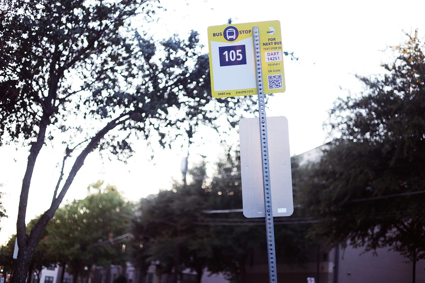 The stop closest to my apartment.
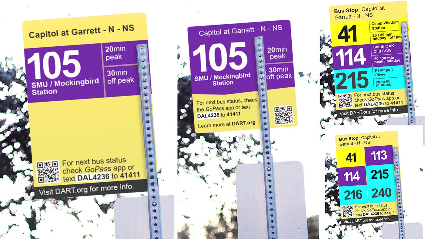
Pictured above is a bus stop for Route 105. As you look at it from your phone or computer screen, there might not seem to be anything “wrong” with it. In order to appreciate what is missing, let’s see what a bus stop could look like.
An Alternative Stop Design
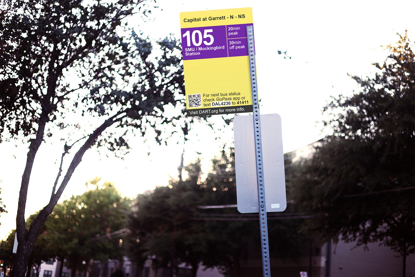 Render of a concept bus stop.
Pictured above is a concept I drew in Photoshop in place of the real bus stop. My goal isn’t to win any design awards. Rather, my hope is that someone would take the principals of this redesign to create a more perfect final design.
Whatever the final design looks like, here are six takeaways from my proof-of-concept:
- Enlarge the route number.
- Use DART route color as seen in navigation instructions.
- Print stop name as seen in navigation instructions.
- Print route destination as seen in navigation instructions.
- List route frequency.
- Remove redundant details.
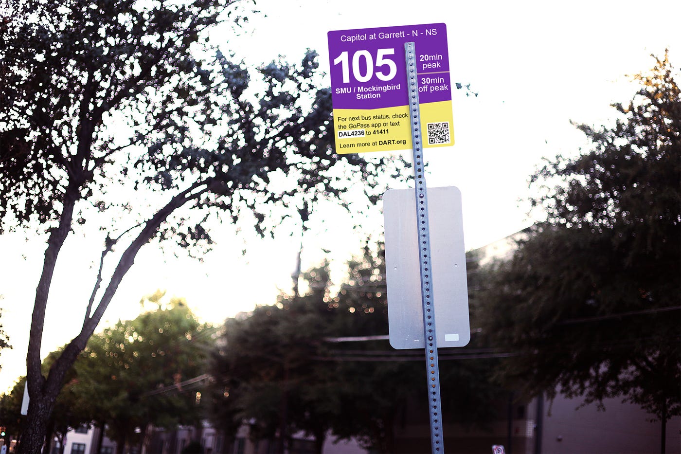 An alternate stop redesign concept. The vast majority of bus stops only serve one route, so this redesign utilizes negative space previously reserved for additional routes.
Improvement #1: Enlarge the route number as much as possible
If someone in a rush is frantically looking for their bus stop, they’re not looking for a sign that says “bus stop”; They’re looking for a sign with their route number.
The bigger and more visible the route number, the less stress for riders new to the route.
The bus stop should have its route number in as large a font as possible.
Improvement #2: Use the route color scheme as seen in navigation instructions
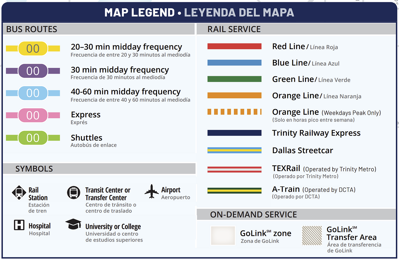 Map Legend from the official DART System Map
All DART’s printed maps and brochures follow a color code indicating bus category and frequency. Color-coded lines help distinguish overlapping routes on the map.
 Excerpt of DART System Map
The color system is also prominent in Google Maps and DART’s official GoPass app.
It’s inexplicable that the color code doesn’t extend to the actual bus stops. At worst, this can be a point of confusion for first-time riders of the system: if the map instructs them to board a “purple 105”, it’s not unreasonable for new riders to question whether that’s the same as the “navy blue 105” on the actual bus stop.
All bus route signage should be consistent with DART’s official color code.
 Google Maps instructions use the official route color.
Improvement #3: Print the stop name as seen in navigation instructions.
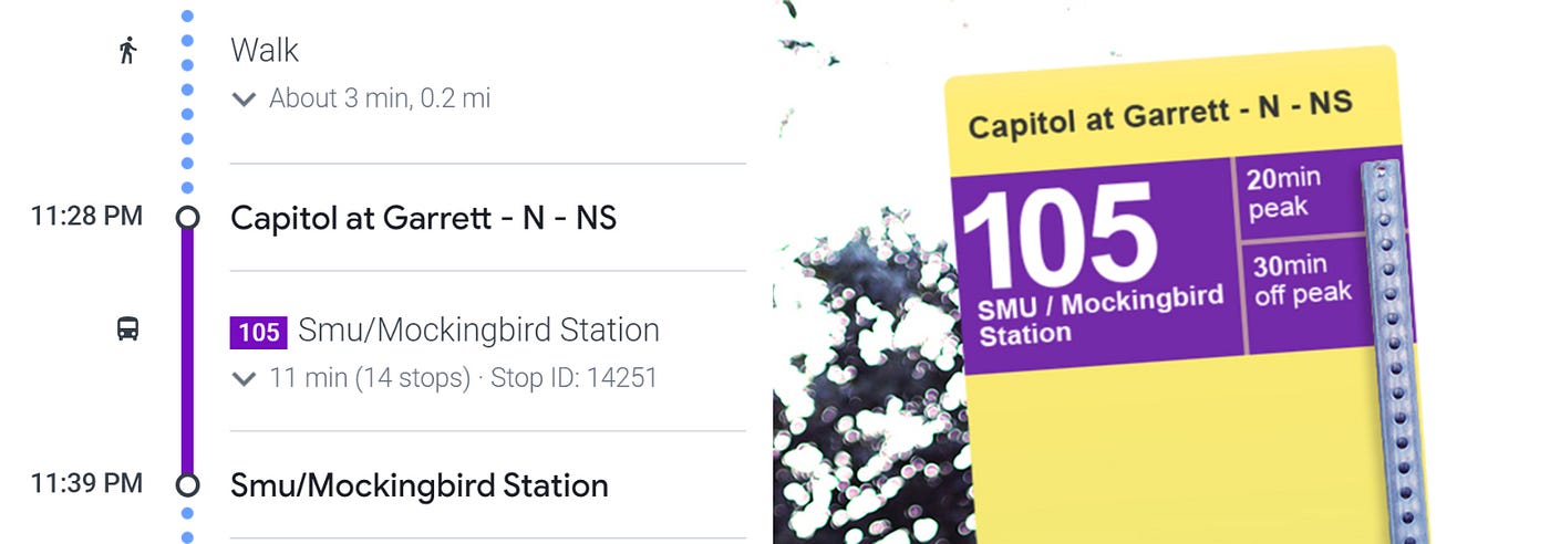
If you have voice navigation turned on, Google Maps doesn’t tell you to “go to Bus 105.” It tells you to “go to Capitol at Garrett” then board Bus 105 from there.
Look at the Google Maps instruction on your screen and you’ll see the name of the stop (Capitol at Garrett-N-NS) in bigger and bolder letters than the bus route number. The same is true on the GoPass app.
This critical piece of information is not printed anywhere on the current bus stop design.
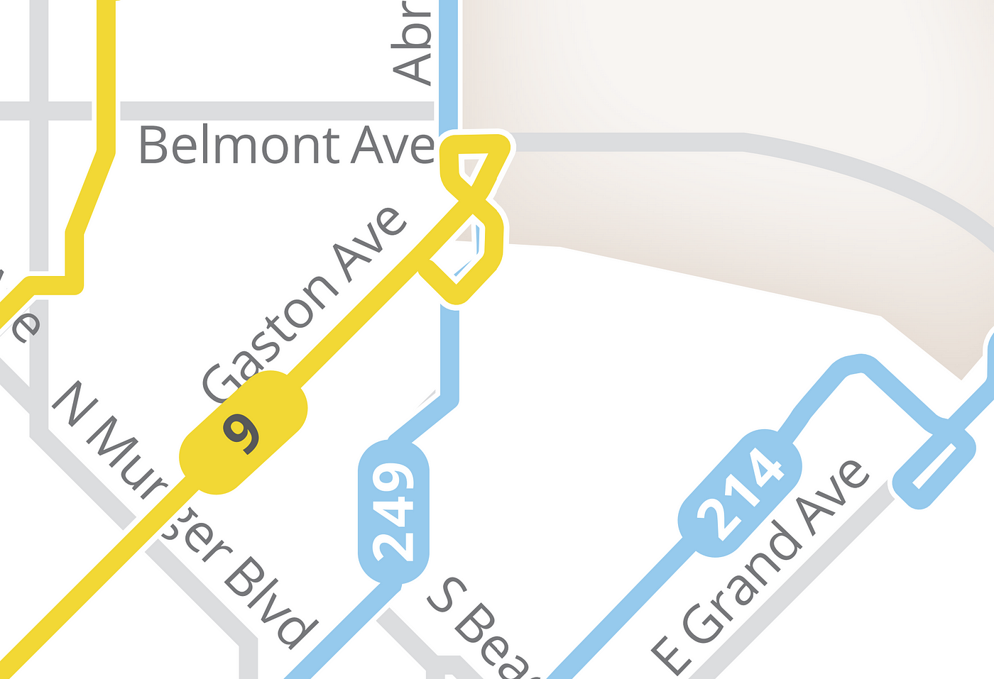
“But if the stop is named after the cross streets, can’t people just look at street signs to figure out if they’re at the right stop?” Yes, they could. But that’s not always easy. It’s especially difficult to do in the dark. It’s even more difficult to tell which is which at intersections with multiple bus stops.

There are three bus stops near this intersection.
Suppose your instructions on Google Maps are to go Haskell at Capitol — N — NS. Can you easily tell which bus stop is yours by looking at the map above?
You may feel regret watching your bus whisk by on the opposite side of the street if you’re waiting at the wrong stop.
To remove doubt and avoid mistakes, bus stop signage should always indicate its name as printed in navigation instructions.
Improvement #4: Print the route destination as seen in navigation instructions.
When you ride transit long enough, you’ll notice people often ask the same questions when boarding the bus. One of the most common is “where is this bus headed?”
Take a look again at the transit instructions on Google Maps and the GoPass app. You’ll notice the route number is always accompanied by the bus’ final destination.
Google Maps instructions include the route’s final destination.
The current bus stop does not indicate final destination. This omission makes navigating DART difficult for people new to the system (or new to a specific route).
Even if you’re at a stop for the correct route, it can be difficult to tell whether you’re at the stop for the bus headed in the right direction. It’s often a guessing game to decide whether to quickly run across the street to the opposite stop.
When multiple bus routes listed on a single bus stop, it can be difficult or impossible to legibly fit the final destination on the sign. But when a bus stop lists only one or two routes, there’s more than enough room.
To remove doubt and avoid mistakes, list the route final destination whenever possible.
Improvement #5: Print the route frequency.
A common adage among transit advocates is that transit systems should be so frequent and reliable that people don’t need to check a timetable for every trip.
Printing the route frequency alone won’t make that happen. However, it’s a low-cost, low-effort way to make the system a little easier to use.
I’ve internalized my bus route’s frequency due to repeated use. I intuitively know another bus will come by in 20 minutes once I step off the bus. I use this knowledge to know how much time to spend in the grocery store, or if I have time to dip into 7–11 for a snack.
Printing frequency on the bus stop could help more riders build that level of intuition. Perhaps it could even imprint on non-transit riders who live or walk close by. Maybe as someone is walking their dog, they may notice the frequency and think “this gives me just enough time to drop Fido off at home and come back to ride the bus to the bar.”
To make the bus stop more useful and inviting, print the route frequency whenever possible.
Improvement #6: Remove redundant details.
With all the new information added by the first 5 improvements, the sign could become overcrowded. Something will need to be removed.
- Do we really need to print the DART logo on everything?
- Do we really need to print the words “bus stop”? Parking spaces don’t need to specify that they’re for “cars”. The word “bicycle” is almost never seen on bike racks.
- Do we really need to print two phone numbers on bus signage?
- Do we really need that bus symbol?
To make space for useful information, remove useless details.
Conclusion
 Multiple concepts for improved bus stop signage.
Fixing the bus stop design isn’t going to magically fix every problem and make everyone’s transit experience better. But it’s a low cost, zero risk way to make the system incrementally better.
—
Thanks for reading. Tweet comments and ideas to @hexel_co. If you agree with my article, considering emailing a DART Board member representing your city.